Of all the components that make up a Phase I Environmental Site Assessment, none is more determinative of quality than historical research. A competent site reconnaissance matters. A thorough regulatory database review matters. But if the historical research is shallow — if it doesn’t reach back far enough, doesn’t use the right sources, or misses a critical land use — then the entire assessment is compromised. You can inspect every inch of a property and still miss the contamination that’s already there, invisible and subsurface, left behind by a tenant who operated there thirty years before your client’s seller bought the land.
I’ve reviewed Phase I ESA reports prepared by other firms that searched five years of history and called it complete. I’ve seen reports where the historical research section consisted of a single database query and a Google Maps screenshot. These reports create the illusion of due diligence while leaving the buyer fully exposed to pre-existing environmental liability.
This is not a minor technical distinction. Under CERCLA Section 107, current owners of contaminated property can be held liable for cleanup costs regardless of whether they caused the contamination. The bona fide prospective purchaser defense — the primary legal protection for commercial property buyers — requires that a Phase I ESA be conducted in compliance with ASTM E1527-21. And the depth and quality of historical research is one of the most important criteria for meeting that standard.
What “Historical Research” Actually Means
The term gets thrown around loosely. In the context of a Phase I ESA conducted under ASTM E1527-21, historical research means the systematic reconstruction of a property’s land use history from its earliest recorded development through the present day. Not five years. Not ten years. All the way back.
The goal is to identify all prior uses of the property that could have resulted in releases of hazardous substances or petroleum products to the environment. A chemical plant that operated from 1952 to 1968 matters just as much today as it would have in 1970. Contamination from that era may still be present in the soil and groundwater. In many cases, it is.
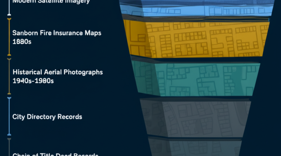
ASTM E1527-21 specifies standard historical sources that must be reviewed, including:
- Sanborn Fire Insurance Maps — The gold standard for urban property history. Sanborn maps document building footprints, construction materials, occupancy types, and tenant uses in extraordinary detail, dating back to the late 1800s in many DFW municipalities. They show where the dry cleaner was located within a building, where the boiler room was, where the floor drains discharged.
- Historical aerial photographs — Aerial photo coverage of the DFW Metroplex extends back to the 1930s and 1940s for many areas. Aerial photos reveal site conditions that no map can show: outdoor storage areas, surface impoundments, burn pits, vehicle storage yards, tank farms. They also reveal features that were subsequently removed or built over.
- City directories — Annual city directories (Polk’s, Haines’) document commercial tenants by address, allowing reconstruction of the sequence of occupants at a given location across multiple decades.
- Historical topographic maps — USGS topographic maps document surface water features, drainage patterns, and land use at various points in time. They’re particularly useful for identifying former agricultural chemical use, former industrial areas, and historical drainage courses that may have concentrated contamination.
- Building permit records — Municipal building permit records can reveal the installation of underground storage tanks, chemical storage areas, and industrial processes that are not visible in other historical sources.
- Chain of title documents — Deed records and environmental liens can reveal prior regulatory actions, voluntary cleanup agreements, and prior knowledge of contamination.
An adequate Phase I ESA uses all of these sources — not a selection of them. Each source provides information that the others can’t, and the gaps between sources are where the most important findings often hide.
Why DFW Requires Deeper Research Than Most Markets
The Dallas-Fort Worth Metroplex presents a particular historical research challenge that environmental professionals from other regions sometimes underestimate.
DFW’s explosive industrial and commercial growth in the post-World War II era — the 1940s through the 1970s — coincided exactly with the period before meaningful environmental regulation existed. The TCEQ’s predecessor, the Texas Water Quality Board, wasn’t established until 1962. RCRA didn’t exist until 1976. CERCLA didn’t exist until 1980.
During those critical decades, the DFW Metroplex developed extensive industrial corridors along railroad lines (particularly in South Dallas, Garland, Irving, and Fort Worth’s industrial districts), automotive and petroleum-related uses (gas stations, service stations, bulk petroleum storage), dry cleaning operations scattered throughout residential and commercial areas, and agricultural chemical storage and distribution facilities.
All of this activity occurred without the environmental controls, waste management requirements, or regulatory oversight that exist today. And much of the land where that activity occurred has since been redeveloped into the commercial properties that are changing hands in today’s DFW real estate market.
The Four Most Common Historical Research Failures
In reviewing Phase I reports and conducting assessments for clients who discovered problems their previous consultants missed, I’ve identified four recurring failures in historical research quality.
1. Insufficient Look-Back Period
The ASTM standard requires historical research to cover the period from “the property’s first developed use.” Many firms interpret this loosely, researching back only to whatever their database provider covers — often 30 or 40 years. In DFW, where the most significant industrial development occurred between 1940 and 1975, this means the most consequential period of a property’s history may go completely unexamined.
The question isn’t “what did this property look like in 1985?” The question is “what is the earliest recorded use of this property, and what happened between then and now?” In areas of central Dallas, Fort Worth, and the inner-ring suburbs, that means researching back to the early 1900s.
2. Selective Source Coverage
Some firms rely primarily on proprietary database search reports (EDR, FirstSearch) and skip the primary source review — the Sanborn maps, the historical aerials, the city directories. Database search reports are useful tools, but they compile regulatory records, not operational history. They tell you about known releases and registered facilities. They don’t tell you about the machinist who ran a degreasing operation in a building from 1955 to 1971 and discharged spent solvent through the floor drain, because that was never in a regulatory database.
Primary source review is irreplaceable. There is no shortcut.
3. Inadequate Radius Coverage for Off-Site Sources
Historical research must extend beyond the property boundary. ASTM E1527-21 specifies minimum search distances for various types of regulatory databases, but the historical research component requires judgment about which off-site sources could represent a recognized environmental condition (REC) for the subject property.
A former industrial facility that operated within 500 feet of your property in 1960 may not appear in any current regulatory database — but the contamination from its operations may have migrated beneath your property over the intervening six decades. Identifying that former facility requires historical research, not database queries.
4. No Photointerpretation Expertise
Reviewing historical aerial photographs is a skill. Identifying surface impoundments, distinguishing stored drums from other features, recognizing evidence of former underground tank installations from surface depression patterns, reading the shadows and textures that indicate former structures — these require trained photointerpretation, not just clicking through images on a screen.
Environmental professionals who conduct Phase I assessments routinely should be competent photointerpretors, or they should have access to qualified specialists. If the historical aerial photo review section of a Phase I report says “no recognized environmental conditions identified” without describing what was observed and why it was or wasn’t significant, that section of the report wasn’t done properly.
A Real Pattern I See in DFW
Without naming specific properties or clients, I can describe a pattern that repeats itself regularly in my practice.
A client is acquiring a commercial property in one of DFW’s older industrial corridors — an area of Garland, Mesquite, Irving, or Grand Prairie that developed heavily between 1950 and 1975. They have a Phase I ESA from a firm that was selected primarily on price. The report finds no RECs. The client closes on the property.
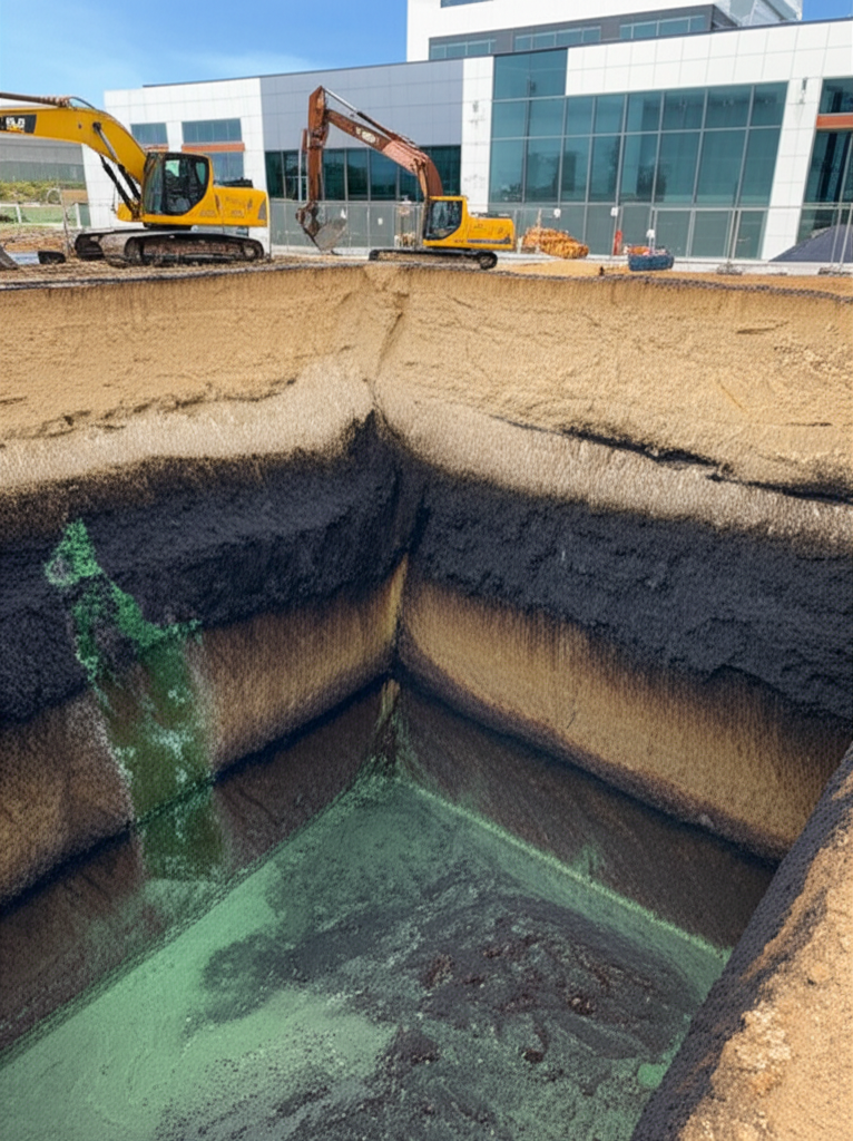
Then, during redevelopment or renovation, contamination is discovered. Soil samples show elevated concentrations of chlorinated solvents, or petroleum hydrocarbons, or heavy metals. The client calls me. We do the historical research that should have been done upfront. Sanborn maps show that the building housed a metal plating operation in the 1960s. Aerial photographs show surface impoundments in what is now the parking lot. City directories confirm a succession of industrial tenants through the 1970s, none of whom appear in any current regulatory database because their operations ended before meaningful regulation existed.
The contamination was there all along. The historical research would have revealed the risk. But it wasn’t done.
What Good Historical Research Looks Like in Practice
When Vertexium Environmental Solutions conducts a Phase I ESA, the historical research component is not a checkbox exercise. It’s a genuine investigation.
We research every property back to its first recorded use. We obtain and review Sanborn maps for every coverage period available. We review historical aerial photographs at multiple time points — typically the 1940s, 1950s, 1960s, 1970s, and every decade thereafter. We pull city directory records for the property address and document the sequence of tenants. We review USGS topographic map coverage. We examine building permit records where accessible. We evaluate chain of title documents for environmental liens and prior disclosures.
When historical research reveals a former use that warrants further evaluation — a former dry cleaner, a former auto repair shop, a former industrial tenant, a former agricultural chemical storage facility — we document it as a Recognized Environmental Condition and explain clearly what additional investigation is warranted and why.
We don’t minimize findings because they’re inconvenient. We don’t describe an identified REC as a “de minimis condition” unless the evidence genuinely supports that characterization. We give our clients the accurate picture of the environmental history — because that’s what they hired us for, and because that’s the standard our professional license requires.
The Difference Between Due Diligence and the Appearance of Due Diligence
There is a meaningful difference between a Phase I ESA that is ASTM-compliant in substance and one that is ASTM-compliant in form. A report can check all the boxes in its table of contents and still fail to provide the environmental professional judgment that the standard requires. Historical research is where this distinction is most apparent.
If you’re acquiring commercial property in DFW — particularly in older industrial corridors, near former railroad lines, or in areas that developed before 1980 — the quality of your Phase I ESA’s historical research component may be the single most important factor determining whether you close knowing what you’re buying, or close unaware of what’s already in the ground.
The CERCLA bona fide prospective purchaser defense is only as strong as the Phase I that underlies it. If the historical research was inadequate, the defense may not hold — and you may be liable for contamination you never caused.
Ready to Talk About Your Property?
At Vertexium Environmental Solutions, our Phase I ESA process is built around the depth of historical research that DFW properties require. Every assessment we conduct is prepared by an ASTM E1527-21 Environmental Professional with doctoral-level environmental engineering expertise; PE stamping for TCEQ submissions is handled via our licensed Texas PE subcontractor network when required.
If you’re evaluating a commercial property in the Dallas-Fort Worth Metroplex — particularly one with any pre-1980 development history — I want to talk to you before you close. The conversation is free. The information could be invaluable.
Schedule your free consultation at vertexiumenv.com/contact.html and let’s make sure your due diligence is actually thorough.
Need Environmental Due Diligence?
Vertexium Environmental Solutions delivers Phase I ESAs with 2-3 week turnaround, fixed-fee pricing, and PhD-level technical review on every report.
Book a Free ConsultationDr. Mohamed Elansary
PhD in Environmental Engineering from Texas A&M University-Kingsville. Founder of Vertexium Environmental Solutions, delivering Phase I/II ESAs and environmental due diligence for commercial real estate across the DFW Metroplex.